surfresearch.com.au
ian hoskins
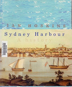
: sydney harbour, 2009
Ian
Hoskins : Sydney Harbour, 2009. Hoskins, Ian:
Sydney
Harbour - A History.
UNSW Press,
Sydney, 2009.
Introduction This
Page
60
Daniel Paine was writing in 1795 and 1796 as confidence in
local timber was growing.
Captain Henry Waterhouse was another enthusiast.
He had sailed to Botany Bay and Port Jackson in 1788 with
Phillip in the Sirius.
In 1794 Henry was the commander of the Reliance which brought
Daniel Paine to the colony, returned Bennelong to his
harbour home and delivered John Hunter as the new governor.
A naval man with a good eye for commercial opportunities on
land, Waterhouse was the first to import merino sheep to the
country.
Some of these he sold to John Macarthur on whose estuarine
estate, Elizabeth Farm, they would begin to multiply and
seed the flocks that came to cover the colony in the next
century.
Waterhouse was very impressed with the quality of the wood
used to
Page 61
1796 by attempting — unsuccessfully — to cross the mountains
that confined the settlement to the harbour and
hinterlandrepair his decrepit Reliance as it lay 'alongside the Rocks in
the town of Sydney' in 1796.
Both straight and crooked timbers were easily obtained
''close to the Water's edge ... through the whole Harbour of
Port Jackson''.
The planking wood was so hard that nails ''drove in'' could
not be removed.
The timber's essential oils and gums were good for more than
medicines and balms, giving remarkable protection against
rot. Unlike northern hemisphere naval timbers such as black
birch, this wood could survive voyaging in warm and cold
waters. Responding to the demand for new sources of naval
timber in 1802, Waterhouse wrote about his own observations
of the first wood that had been felled around the harbour
and his incidental experiments conducted over two tours of
duty in the colony.
He examined the trunks that had been cut and rolled into the
harbour to create the first clearings back in 1788.
They had apparently survived a decade in saltwater
unaffected: "Logs when taken up again in 1798, were as sound
as when cut down — not the smallest appearance of
decay."(32)
The peculiarities of this perverse nature were at last
delivering benefits.
The official activity on the harbour occurred in the
government boat-shed built on the eastern side of Sydney
Cove in 1788 and the new yard laid out on the west side in
1797.
By the end of that year there were 16 shipwrights,
boatbuilders, labourers and watchmen working.
These men built a pinnace and other small craft for the Reliance and the Supply.
Repairs were carried out on the boat that came out with the
Pitt.
Several small boats used at the South Head fishery and by
the hospital were also reconditioned.
The boatyard had been improved further with various sheds
and a ''steamer'' erected for seasoning planks.(33)
For the settlement up at Parramatta they had also built a
'whaleboat', a long rowing boat often fitted with a sail.
This was probably the ''excellent'' cedar-and-banksia craft
made available to the adventurous surgeon George Bass so
that he might explore the south coast while his ship the Reliance was being
overhauled in Sydney Cove.
Bass had proved his ''active disposition'' in
Page 62
1796 by attempting —
unsuccessfully — to cross the mountains that confined
the settlement to the harbour and hinterland. He had already investigated Botany Bay and
the Georges River with Lieutenant Matthew Flinders in an
2.4-metre boat called Tom
Thumb.
A similarly small craft, also called Tom Thumb and built in
Port Jackson, took Bass into Port Hacking farther south.(34)
He would later explore the coastal coal seams at what would
be called Coalcliff.
In December 1797 Bass and six others took the harbour-built
whaleboat down past Point Hicks, the place where James Cook
had first sighted the Australian coast.
The 1900-kilometre trip took 12 weeks and along the way Bass
found Jervis Bay, Shoalhaven River, Twofold Bay, Wilsons
Promontory and Western Port.
So great were the swells off the southernmost tip of the
mainland that Bass thought he was in a strait of water
separating the mainland from Van Diemen's Land.
He would prove this with Flinders later in 1798 when the
pair circumnavigated the island.(35)
In this way the vast colony of
New South Wales was slowly consolidated: ships and small
boats setting out from Port Jackson naming bays and
interesting rivers and claiming distant islands.
Bass's discovery — which promised to shorten the trip from
Britain's South African Cape colony to Port Jackson - was
named Bass Strait in the surgeon's honour by Governor Hunter
in 1799.
The whaleboat survived for a time as a waterside shrine:
'preserved in the harbour with a kind of religious respect',
in the words of the visiting scientist Francois Peron.
A few snuff boxes were made from its keel and treasured as
'relics' by those lucky enough to obtain them.
On the French map of Sydney Cove, the position of 'Chaloupe
de M. Bass' - Mr Bass's rowboat — was expressly marked
sitting below the Rocks.
Its inclusion placed it alongside other noteworthy sites,
such as the granary, the defensive battery and the
governor's house.
A fragment of its timber was decorated with a silver band
engraved with the details of Bass's discoveries.
Hunter's successor as governor, Philip King, presented this
to Nicholas Baudin, Peron's commander, in 1802.(36) Page 63 It was a poignant gift for a
Frenchman.
Enacted in a brief moment of peace between the two nations,
the act was undoubtedly a gesture of conciliation.
King had already extended extraordinary hospitality to the
crew of the two French ships — providing fresh food and care
for the many suffering from scurvy, and even approving the
sale of a locally built schooner to the expedition (the Casuarina, so-named
after the useful she-oak that lined the harbour's edge).
King knew the presence of these ships was a temptation for
would-be stowaways and he ordered that a government cutter
be rowed round and round the little fleet all the while it
was in the harbour.
Yet there was suspicion of the French as well.
Baudin's ships were sharing the har¬bour with the
Investigator, captained by Matthew Flinders and sent to
chart the Australian coast in response to the French
expedition.(37)
With its cartographic inscription, the embellished chunk of
wood from Mr Bass's rowboat might also, therefore, have
served as a subtle reminder to the French of who had been
quick enough to claim the spoils of discovery in 1788.
For his part, Matthew Flinders
sailed out from Port Jackson and turned left as Baudin went
right and headed south.
George Bass's little harbour-built boat still lay near the
place where the colony had been declared in January 1788: a
memorial to the imperial endeavour and, perhaps, the skill
of the local boatbuilders.
Flinders continued his circumnavigation around the northern
coastline and returned to Sydney's harbour in June 1803.
He named the continent he had circled ''Australia".(38) Page 143
While Pockley, Harnett and the Milsons were
enjoying the salt spray aboard their racing yachts, others
were immersing
themselves in the harbour itself.
The therapeutic benefits of the sea had been
appreciated by Europeans for a hundred years.
The English went to Brighton, the
French to Nice - to bathe and be rejuvenated by sea air.
Some even drank the
salty liquid in the hope of curing jaundice and other
ailments.
The physical
stimulation was enhanced by the underlying sense of danger
and awe generated
by the Sublime vastness, power and coldness of the sea.
With temperate waters
and no waves, the main threat in Sydney's saltwater came
from the ever-present
sharks.
Fifty years earlier, Governor King had warned convicts of
these
''voracious'' fish and forbade them from bathing in Sydney
Cove — presumably for
fear of attracting the monsters to the bay.
Nonetheless, bathing, often nude,
was very popular.
So much so that Macquarie had again forbade the practice at
the government wharf and dockyard, this time
Page
144
in
the interest of decency.(59)
But the governor could recognise a good
beach himself.
In 1821 he had noted that the pilot's station at Watsons Bay
was
''admirably well calculated for sea bathing, there being a
very fine smooth
sandy beach below the House for that purpose''.(60)
In 1828 Ralph
Darling's castellated bathhouse provided more accessible
privacy for the
governor's vivification.
By then a fondness and aptitude for swimming was being
recognised as a defining characteristic of a distinct
colonial ''type''. Local
boys seemed oblivious to the dangers of sharks and many of
the girls of the
port could ''swim and dive like waterhens''.(61) There were
baths in
Darling Harbour in the 1820s and, in the 1830s, swimming
enclosures had opened
for men and women in Woolloomooloo Bay.
The men's baths used the hull of an
obsolete American-built paddle steamer called the Ben Bolt and took its
name from the same. By
the 1860s children were swimming around the wharves of
Darling Harbour without
supervision and also, it seems, from the beach at the bottom
of the Brisbane
House garden across the harbour.
That small spot was known colloquially as ''the
reserve''.
James Milson disapproved of the bathers while coveting the
waterfront
and he applied to acquire the foreshore and the land down
to the low-water
mark.
The attempt prompted the local member for the Legislative
Assembly,
William Tunks, to mobilise his constituents and oppose the
application on the
grounds that so much of the waterfront to the west and east
had already been
alienated from the public.
Tunks was developing a passion for defending public
lands around the harbour.
When Milson's application was approved, Tunks took
it before a parliamentary committee and ensured he was the
chairman. The
value of controlling foreshore land had dawned on colonial
authorities rather
late.
Had Milson confirmed his 20 hectares before 1828 the
waterfront would
have been his.
For the first 30 years of colonisation there was,
apparently,
plenty of foreshore.
The land between Rose Bay and Watsons Bay, where Vaucluse
would subsequently be built, was alienated from 1793.
Page 145
In
that year John Piper acquired his 285 hectares to the
east, having already
secured the Point Piper estate opposite.
It
was not until 1825 that Governor Brisbane was instructed to
consider the
importance of reserving public ownership of land near, among
other places,
''navigable streams or the sea Coast, which may be
convenient at some future
time to appropriate Quays and Landing Places''.(62)
In 1828 Darling
decreed that 100 feet (30 metres) be reserved above high
water around ''the Sea
Coast, Creeks, Harbours and Inlets'' on all Crown land still
unalienated.(63)
But by then much of the foreshore land around the harbour
had been sold or
simply given away.
By
the
1860s the government was clawing back some of this
foreshore.
Land at
Middle Head and Georges Head was resumed for defence.
In 1866 the democrat
Tunks was more concerned about public access and recreation.
There was the
Domain enclosure and a ''warm and cold seabathing
establishment'' at the popular
resort of Manly Cove — near the spot where man and shark had
fought for
possession of the Dunbar
corpse — but little else in
'ninety-five miles [150 kilometres] of water frontage''.
Tunks was as tenacious
as he was dismissive of the evidence that suggested that
Lavender Bay was in
fact not well suited to bathing.
His committee duly recommended that
''facilities should be afforded for public recreation and
cleanliness especially
among the working classes; and that places for sea-water
bathing are desirable,
as affording a healthful and invigorating recreation, and
calculated to
administer to the comfort, as well as to develop the
physical powers and
courage of the people'', and that the contested site at
Lavender Bay ''be
permanently reserved as a place of public recreation and as
a site for public
baths''. (64)
By
the early 1900s there were baths at Lavender Bay, Pyrmont,
Balmain and more up
the river.
''Professor'' Fred Cavill operated enclosures at Farm Cove
and Woolloomooloo.
He had leased baths below the Milson property since the
1880s to instruct
Sydneysiders in the 'noble art' — for
Page 146
they
were, after all, ''constantly on the waters of the
Harbour''.(65)
It was
there, reputedly, that his son Dick developed the Australian
crawl, the overarm
style that revolutionised competitive swimming around the
world.
It was at
Lavender Bay also that the young Barney Kieran, the graduate
from Henry Parkes'
nautical school, broke the world record for a 440-yard
(400-metre) swim in
1905.
Kieran travelled to Britain to compete that year, where he
bettered more
records and was declared, by an astonished onlooker, to be
''a fish, not a man''.(66) Kieran
was not the first ''colonial'' champion to emerge from the
people's harbour.
The
rower Edward Trickett had a local pedigree to rival Kieran,
having grown up
beside the Parramatta River and married the daughter of the
South Head
lighthouse keeper.
In 1876 he became ''the champion sculler of the world''
after
defeating the Englishman James Sadler on the river Thames.
The following year
''the harbour was dotted with every imaginable species of
craft'' as Sydney's
traditional Anniversary Day regatta celebrated both imperial
foundations and Trickett's
achievement on the water.(67)
The presentation of a public purse of
''900 sovereigns'' made the sentiment all the more tangible.
The water and the
quay was crowded again in 1887 with well-wishers trying to
glimpse and touch
the muscular sculler William Beach when he returned from
another successful
colonial assault upon the British.
The Illustrated Sydney
News described the ''magnificent affair'' in a
manner that was both biblical
and almost profane: ''To see Beach, to touch him, to rub
shoulders with him, was
an enviable joy, while to walk in his footsteps around the
town was the
consummation of all earthly joy.''(68)
The adulation accorded
Trickett and Beach reflected the incipient sense of
nationalism in the colony,
an identity increasingly separate from the imperial centre
that immigrant and
local-born still called ''home''.
Four years after Federation, the world champion
Kieran was one of Australia's first truly national heroes.
He soon became one
of its first tragic heroes
Page 146
Kieran
died of appendicitis within weeks of returning to the
harbour city - at the age
of 19.
The inscription on his grave echoed the intent behind
William Tunks's
campaign for public bathing at the bay where Kieran
broke his first record: ''He
won his laurels by courage, self-denial and patient
effort.''(69)
Page167 The
Picturesque Atlas of Australasia
probably did more than any other single
publication to bring quality illustration to the people. Some fifty thousand
subscribers received their monthly instalments between 1886
and 1888.(23) The Picturesque Atlas included
some of the best engraved images yet
published in the colony. Three of its staff artists,
Frederick Schell, W. T.
Smedley and W. C. Fitler, were recruited from North America
and the publication
also employed some of the finest colonial artists working
commercially. Among
them were Tom Roberts, AH Fullwood and Julian Ashton, all,of
whom socialised
with Arthur Streeton at the Curlew Camp. The
subject matter of this and other illustrated publications
was dominated by
rural rather than urban scenes. As one contemporary observer
noted, next to the
dramatic subjects, Australians loved ''horses, cows or
sheep'' in their pictures.(24)
The Picturesque Atlas
also included a great many city views. Most
were of grand buildings and boulevards but some, such as
Fitler's engraving of
Sydney's Haymarket area, captured the intensity of
Page 168 the urban crowd. The harbour, not surprisingly,
was well represented.
Fitler and
Schell executed most of these, including the boatsheds at
Lavender Bay and a
very Venetian rendering of waterside villas at Elizabeth Bay
and Darling
Point.
Ashton pictured Fort Macquarie with discoloured stonework
and
shell-encrusted foundations, which spoke of an ''ancient''
lineage and would have
delighted its originator and namesake.
Ashton's Shipping, Circular Quay showed tall-masted ships
being loaded and
unloaded on the east side of the quay.
The image was probably copied from a
glass-plate photograph and it accompanied a brief mention of
''the strong-pulsed
life and bustling activity'' at the cove.(25) Yet
the lumpers in Ashton's picture were hardly bigger than
ants.
There was no place
for character studies of wharf workers, sailors, fishermen
in the Picturesque Atlas,
no portside equivalent of Ashton's rangy Boundary Rider, who
appeared in volume 3, or the axeman of
Streeton's The
Selector's Hut.
The
situation was different 40 years earlier, when one of the
earliest illustrated
newspapers had shown a one-legged mariner looking out at the
harbour through a
waterfront window.
It accompanied a poem called ''The Retired Seaman'', a
nostalgic romance of the sea
But that was in 1847, when memories of a Port
Jackson whaling fleet were still fresh and the gold rush and
Selection Acts
(which made land for grazing and cropping available to those
with limited
means) had yet to tempt the adventurous to the interior.
In 1896 one Royal Navy
officer from the harbour's Australian station could
generalise that the
Australian-born does not appear to take readily to a
seafaring life as a
profession'.(26)
Hoskins, Ian: Sydney
Harbour - A History.
UNSW
Press, Sydney, 2009.